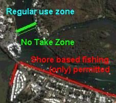
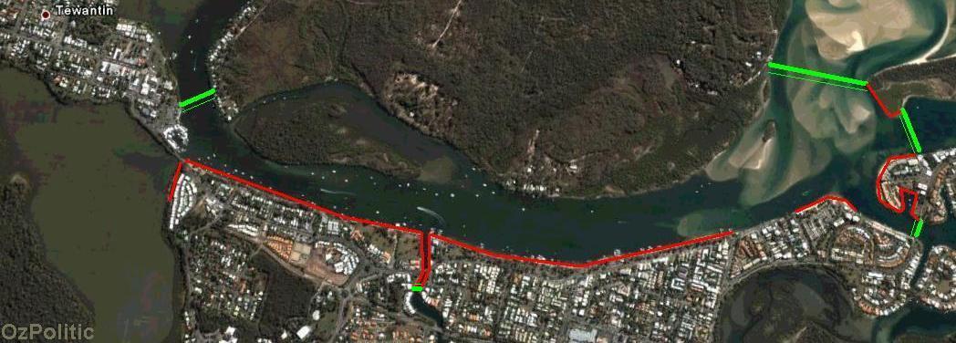
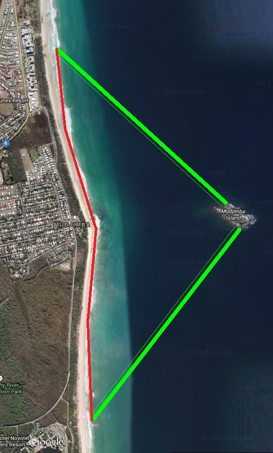
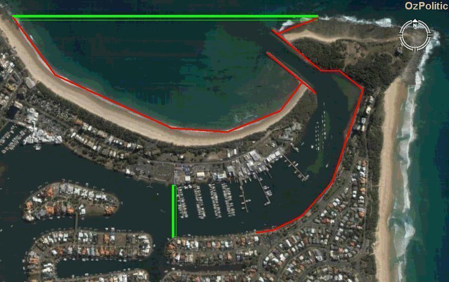
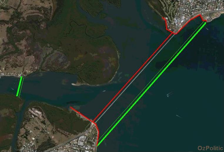
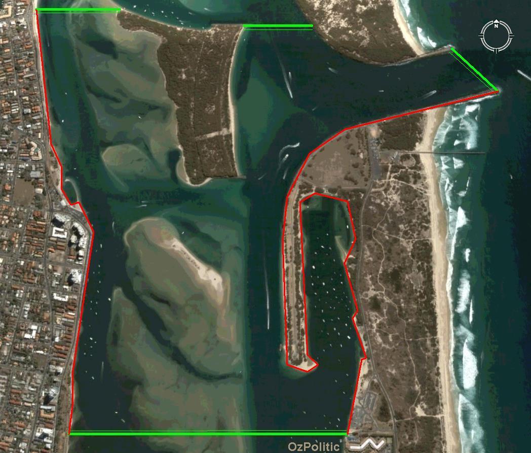
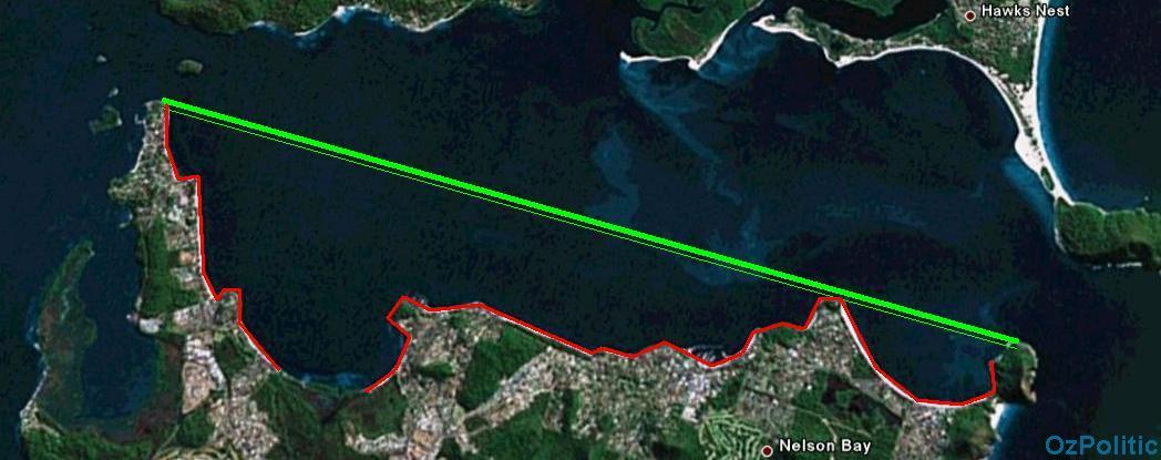
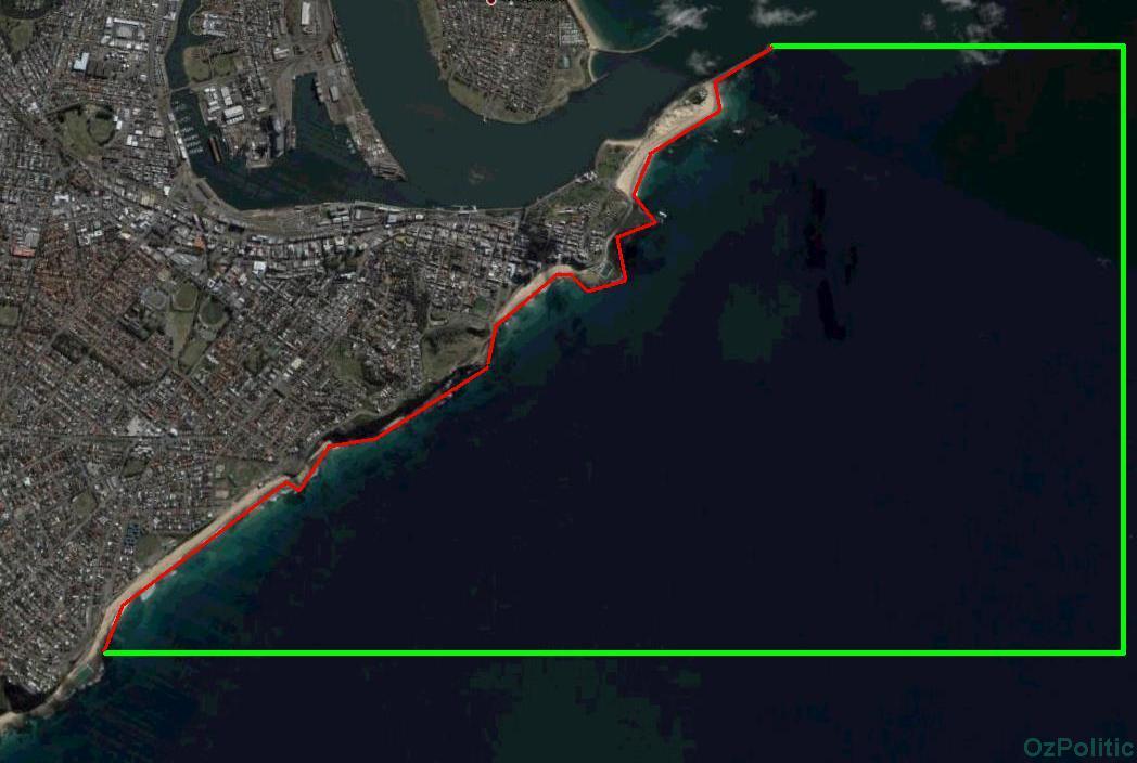
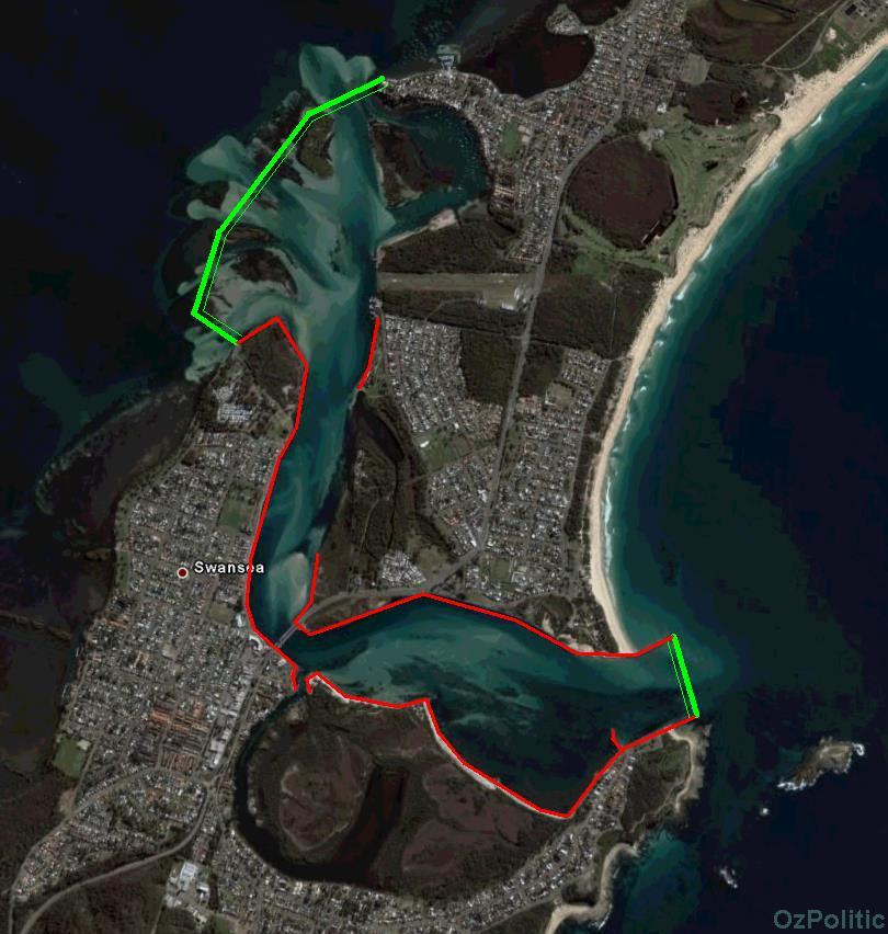
Marine park examplesCheck out our hunting and fishing discussion board.Here are some examples of how the principles outlined in the article on marine parks as a fisheries management tool would apply in practice. As shown in the legend below, a thick green line indicates the No Take Zone (NTZ) boundary, with a thin green line showing which side is the NTZ. The red line along the shore indicates where shore based fishing is allowed.
Submit a map of your local area with a suggested NTZ. Use google earth, an aerial photo or a tourist map for the base. Save the file in .jpg format, open in MS Paint or equivalent and add in the green and red lines. Use shades of green and red that are easy to distinguish from the background. Marine parks achieve the biggest spillover benefit for fishermen when they are smaller and more numerous, rather than larger and fewer. However, when you get down to a size comparable to casting distance, defining the boundaries becomes complicated. No Take Zones (NTZ's) with dedicated shore based fishing zones get around this problem to allow the smallest effective size for a marine park. They are most suitable for easy to access areas that are popular with tourists and irregular anglers. In addition to maximising the spillover benefit, they also deliver the resource to those who value it most - fishermen who don't normally catch much. They do not discriminate against boat anglers, as all anglers are allowed to fish from the shore line. They merely reduce (but only slightly!) the advantage of expensive equipment like boats, thus helping to reduce the 'arms race' that is seeing recreational fishermen spend more and more money to catch less and less fish. The shore based fishing spots indicated above should cover most or all of the easily accessible shoreline. However, they should not include fragile shoreline such as mangroves, soft mud or seagrass beds. Rock walls and 'hard' sand can tolerate foot traffic from fishermen without unnecessary damage to the ecosystem. If you think an error has been made please let us know. Fishing from publicly accessible jetties should be allowed, but not from private jetties. Reasonable allowance should be made for fishermen who wish to wade in up to waist deep, as is common in some areas (specifically, Swansea, just upstream of the bridge). The examples shown above are not intended to represent 20% of the broader area. Rather, they were selected as the best examples of how the concept of shore based fishing zones could benefit recreational angling in the local area. The shore fishing zone will reduce the effective area of the no take zone and this should be taken into consideration, however the NTZ's still have substantial conservation value. Additional NTZ's, selected either on the same principles or where necessary on the basis of conservation needs could be added elsewhere to bring the coverage up to 20%.
|